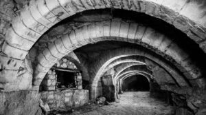
The history of underground quarries in Paris goes back centuries. These quarries were exploited to provide the building materials needed for the city’s growth. However, these exploitations often had disastrous consequences, with landslides and fatal accidents.
A notable example is the collapse of Denfert-Rochereau in 1774, which resulted in the formation of a gaping chasm in the heart of the city. Another serious incident occurred in Clamart in 1776, where a collapse caused considerable damage to surrounding properties.
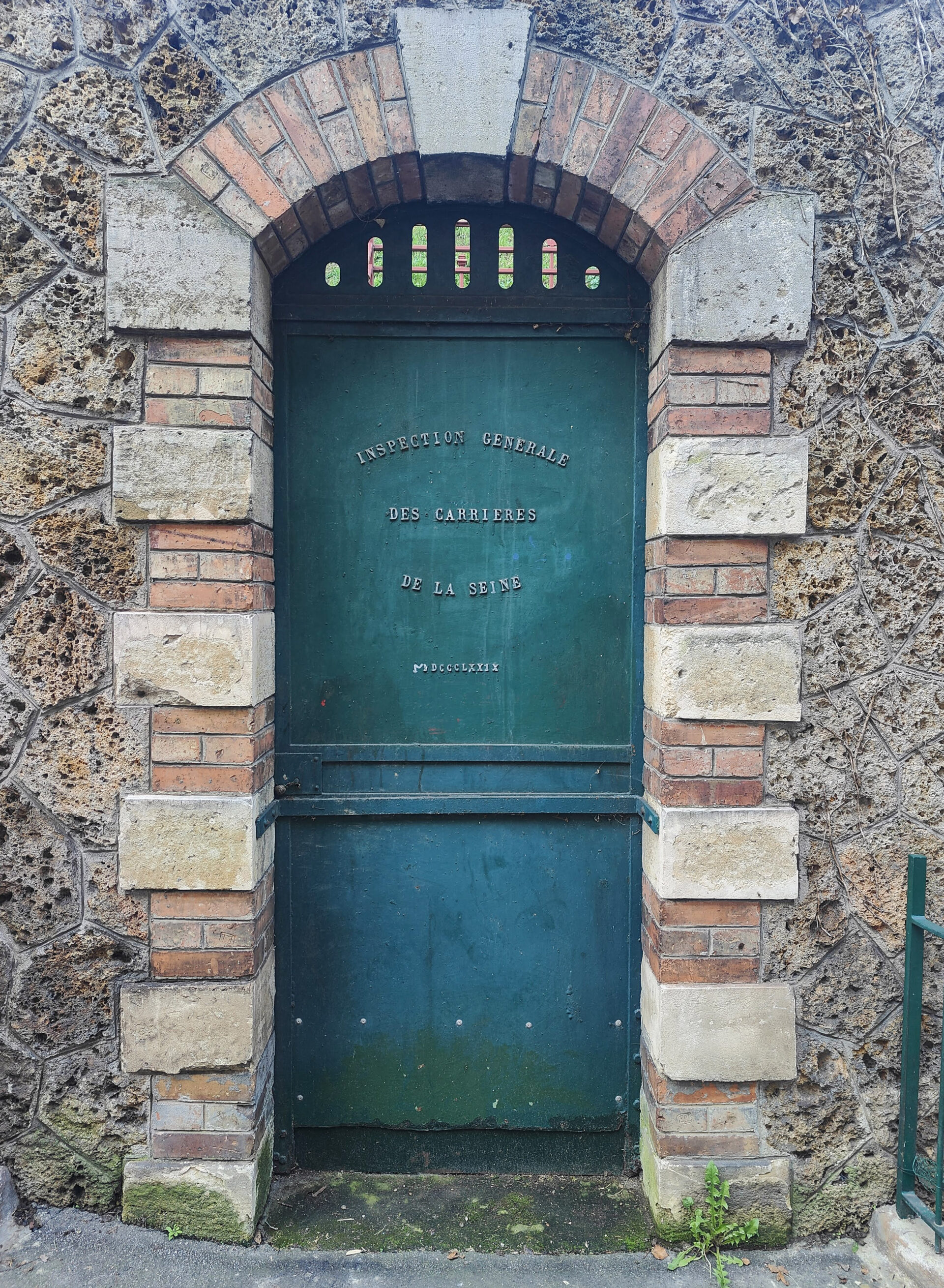
Faced with these dangers, the General Inspection of Quarries was created in 1777 under the reign of Louis XVI and headed by Charles-Axel Guillaumot. Its main purpose was to monitor and control voids in the Paris region. This creation was a direct response to the landslides that threatened public safety. The Inspectorate undertook mapping, consolidation and documentation work on existing quarries. Surveillance was strengthened for new extraction activities.
Missions and functions of the General Inspection of Careers
Safety: stability of voids
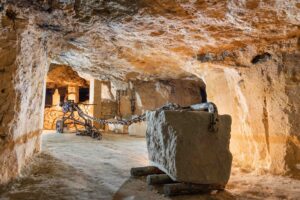
Among the traditional consolidations carried out at that time, we mainly found the hedges and tampings, the arm pillars and the masonry pillars. Detailed article on the uses and functions of consolidations here.
Masonry required lime to be stable. For this, it was necessary to have lime basins to make this binder on site. It should be remembered simply that lime is a binder that allows the walls to breathe while cement, although faster to set, is completely waterproof.
This lime had to be slaked with water, hence the general presence of water wells near these workshops.
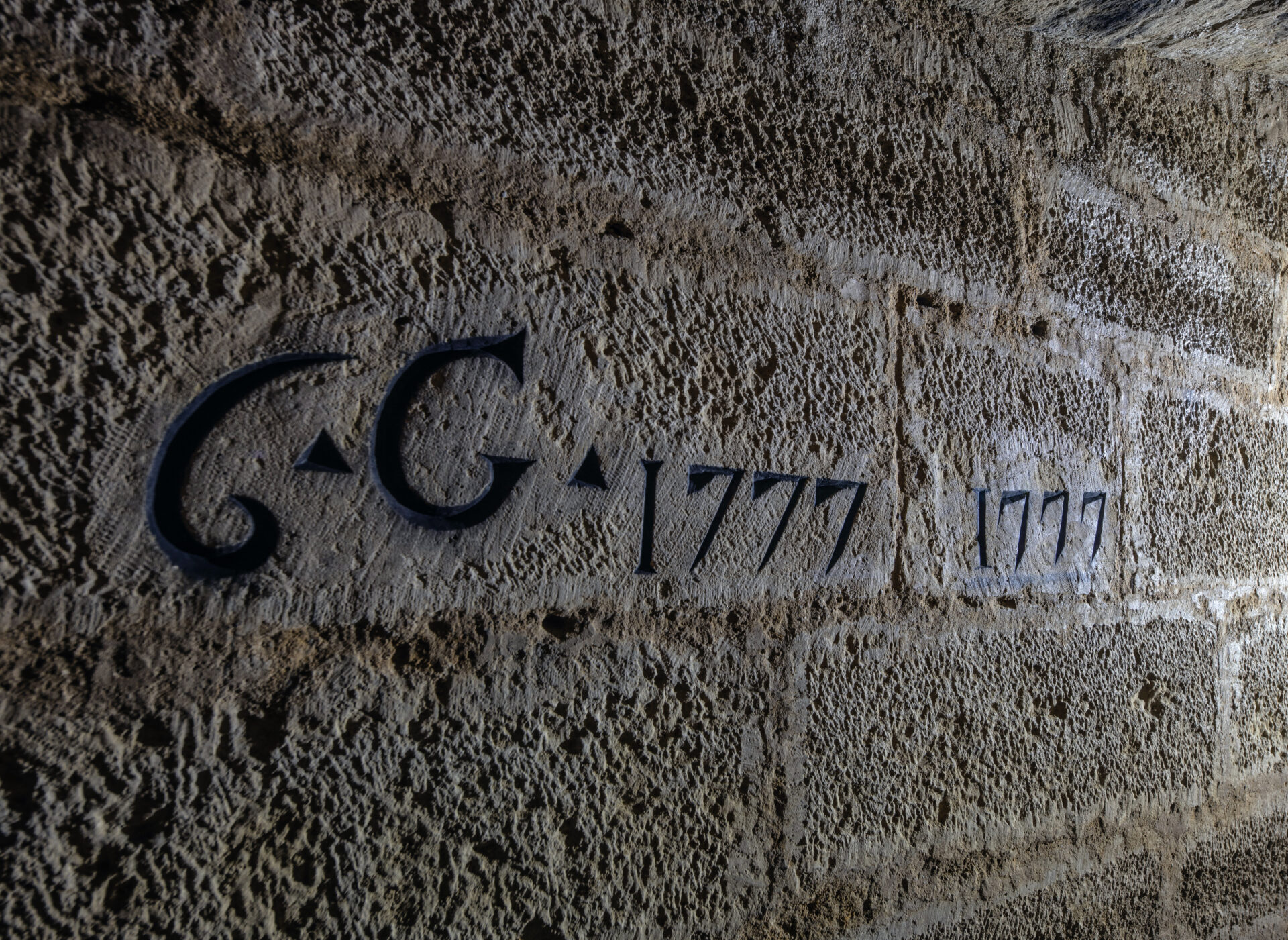
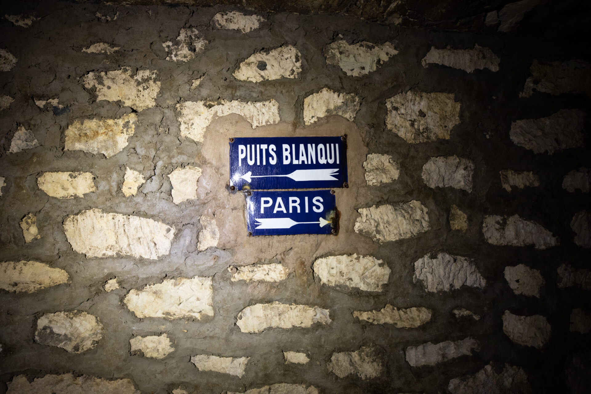
In this objective of consolidation and site monitoring, it was necessary to keep track of this work and to be able to navigate it. For this, there are two main types of plates: consolidation plates and street plates.
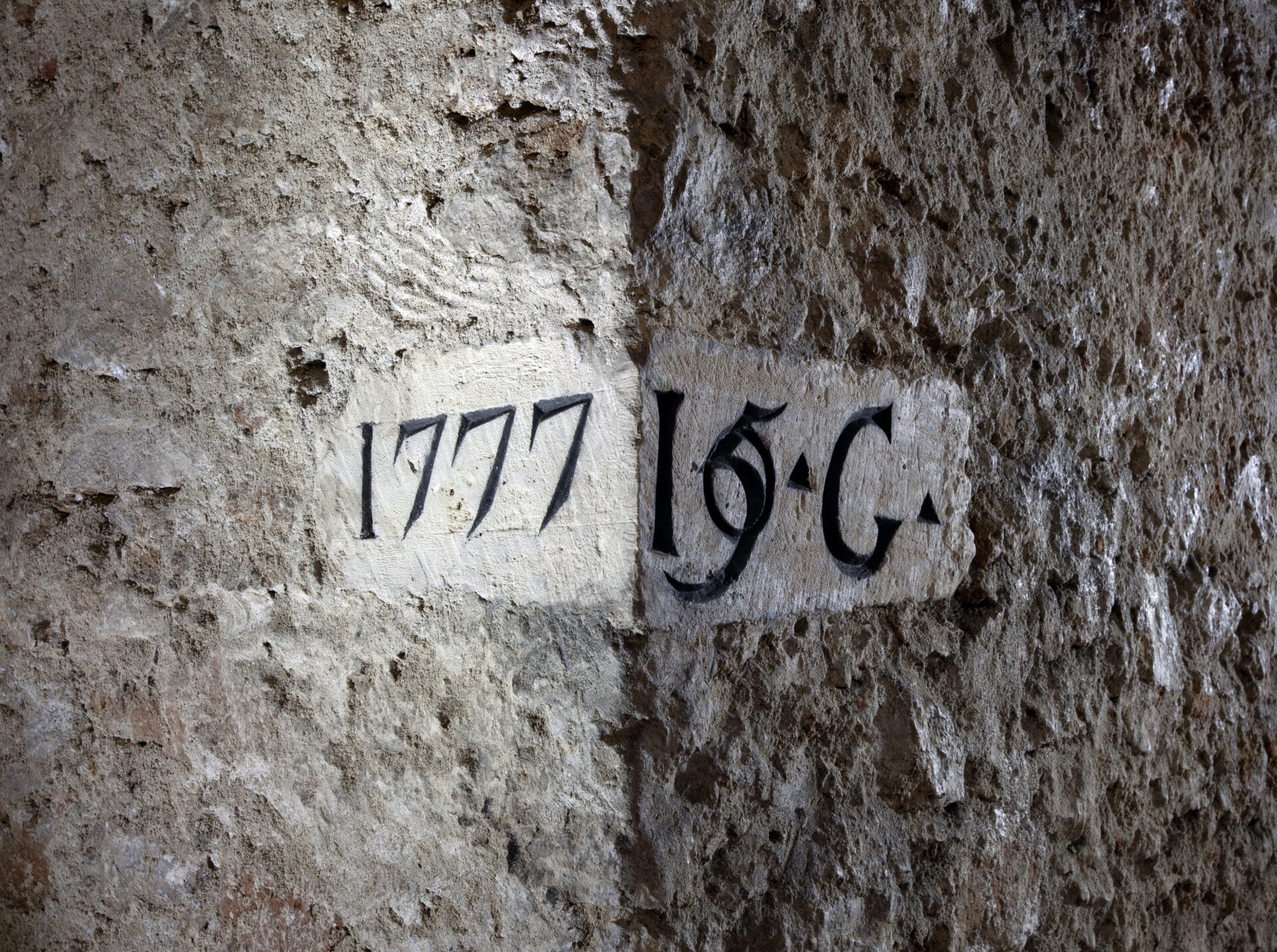
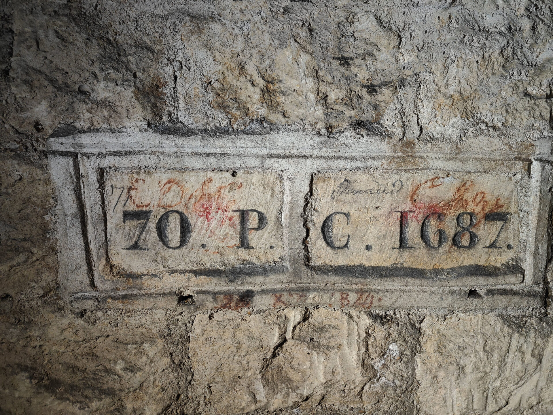
The consolidation plates indicated the creation number of the pillar, the initial of the chief inspector in office at the time of construction and the year of its completion. They are found on pillars as well as on sinkholes, for example.
6e Consolidation de l’inspecteur général des carrières Guillaumot en l’an 1777
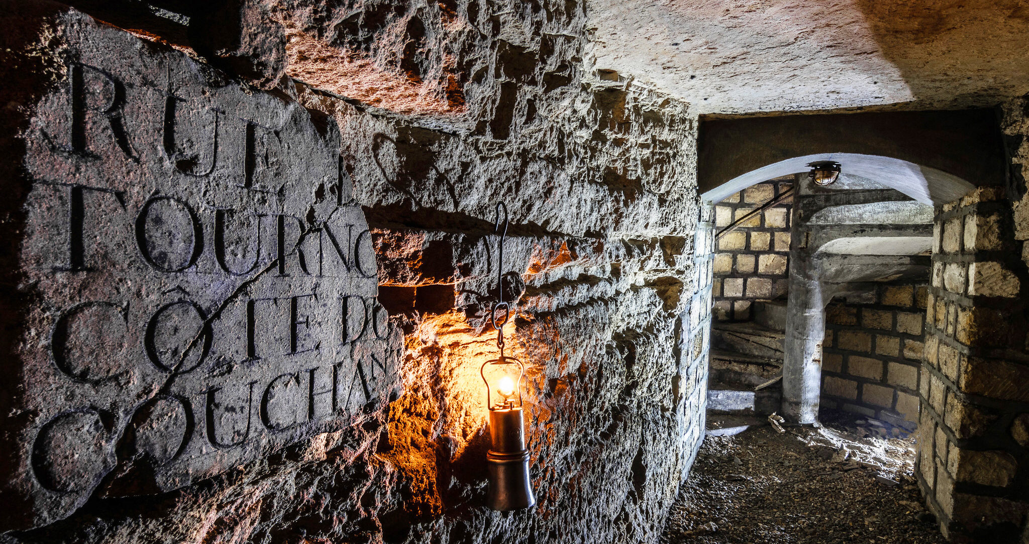
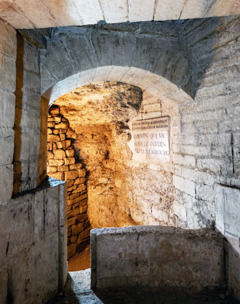
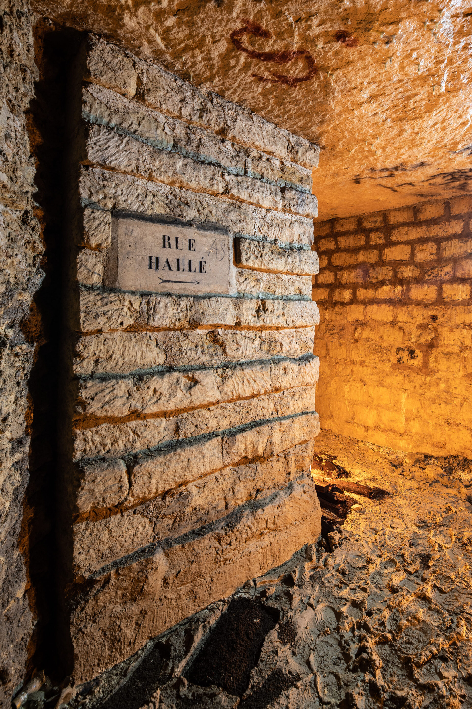
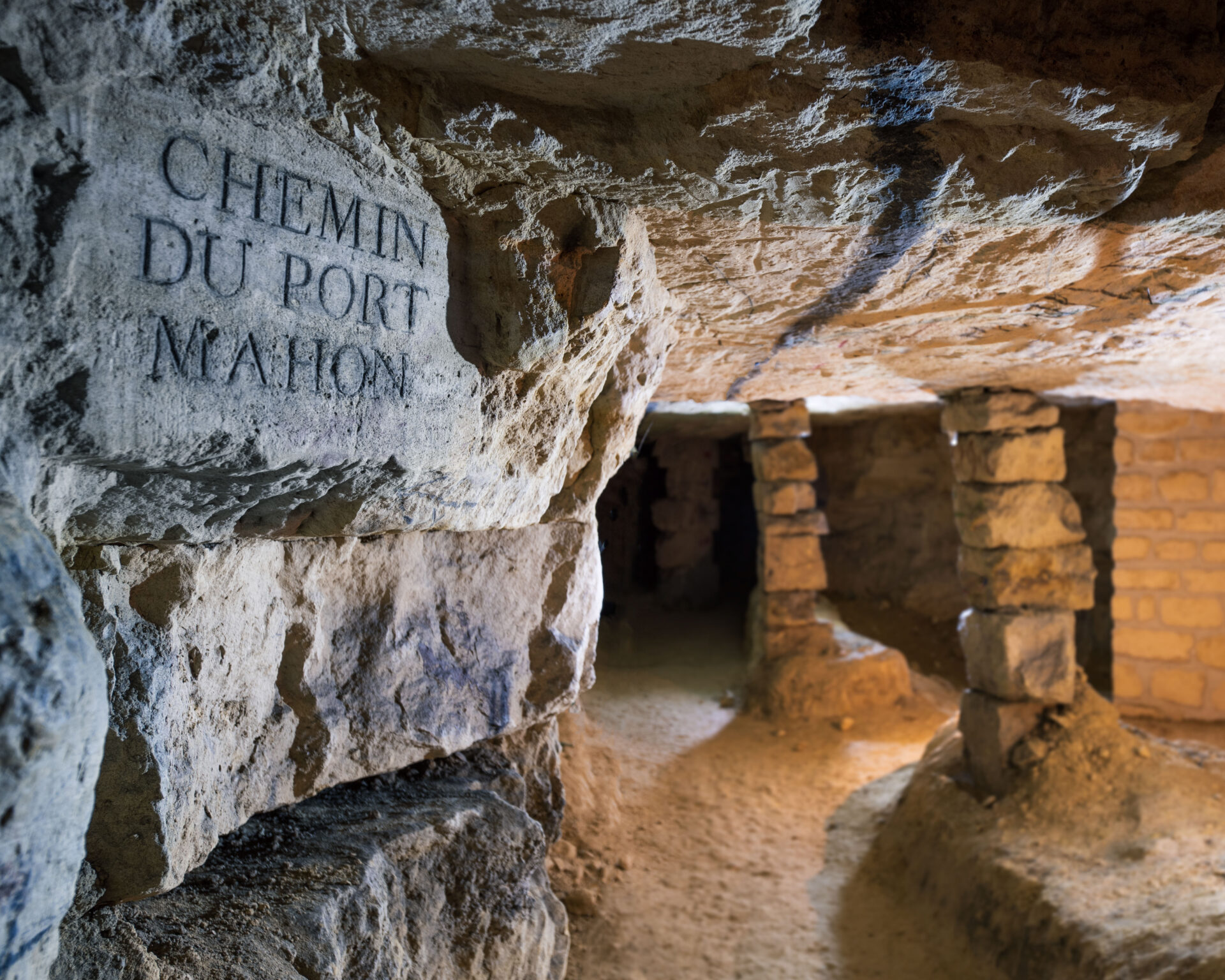
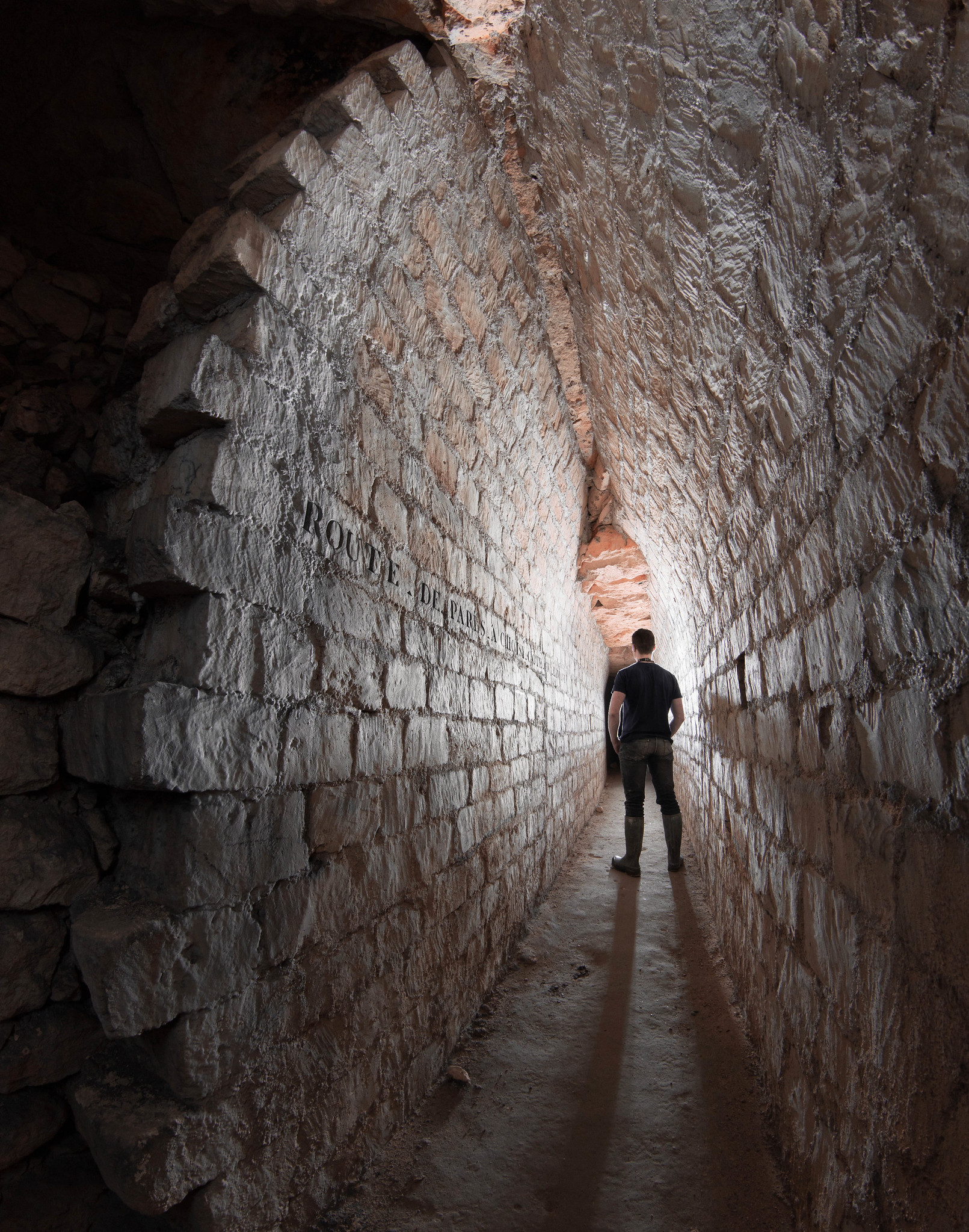
The street signs, for their part, were used to guide the people in charge of inspections or work. The inspection galleries generally corresponded to the surface streets.
Rue Hallé
Avenue d’italie

Chemin du Port Mahon
Route de Paris à Choisy
Sometimes we find some mistakes made by careless workers when cutting the plates.
Le N est à l’envers
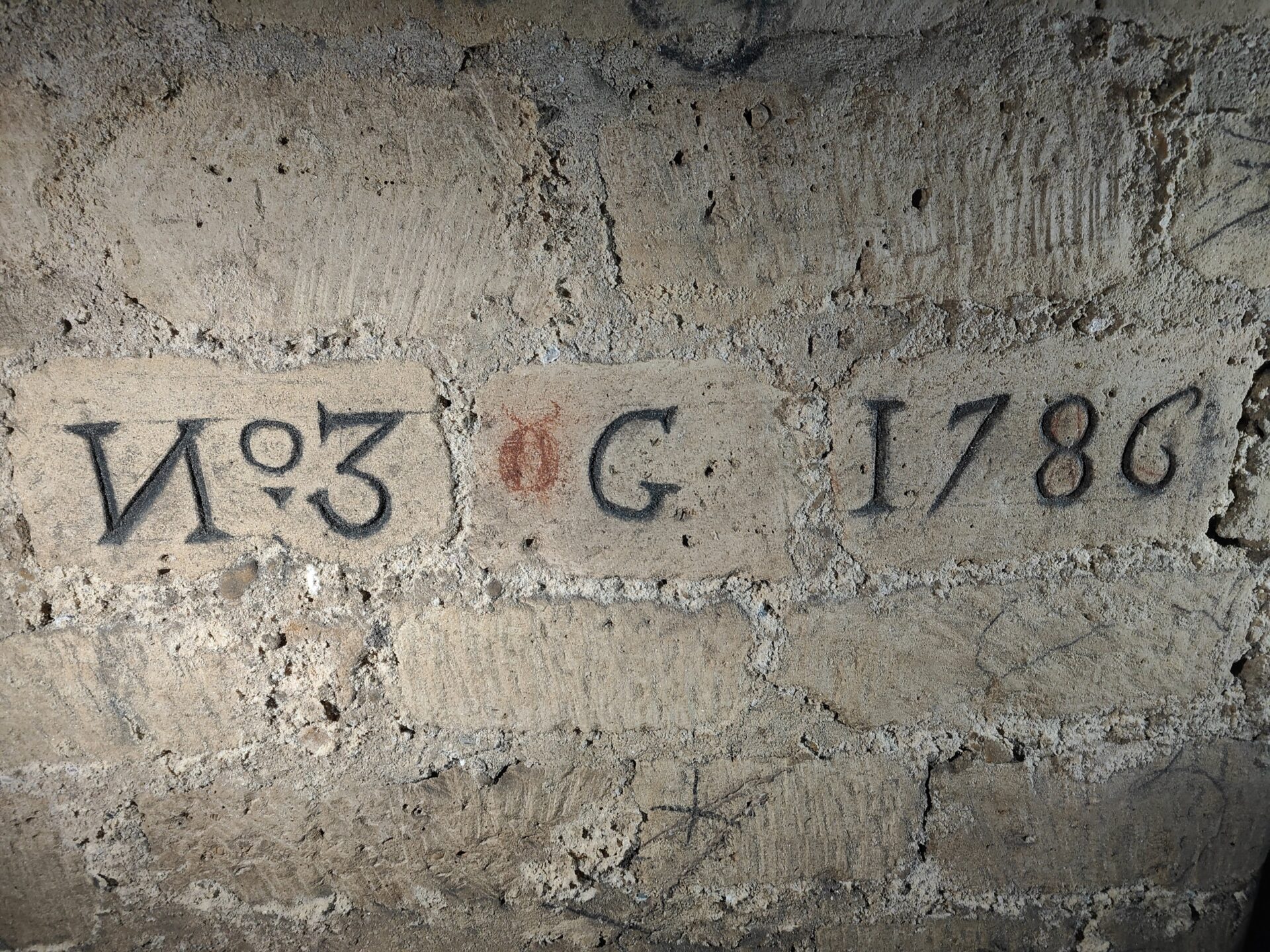
L’ouvrier a gravé 1687 au lieu de 1786
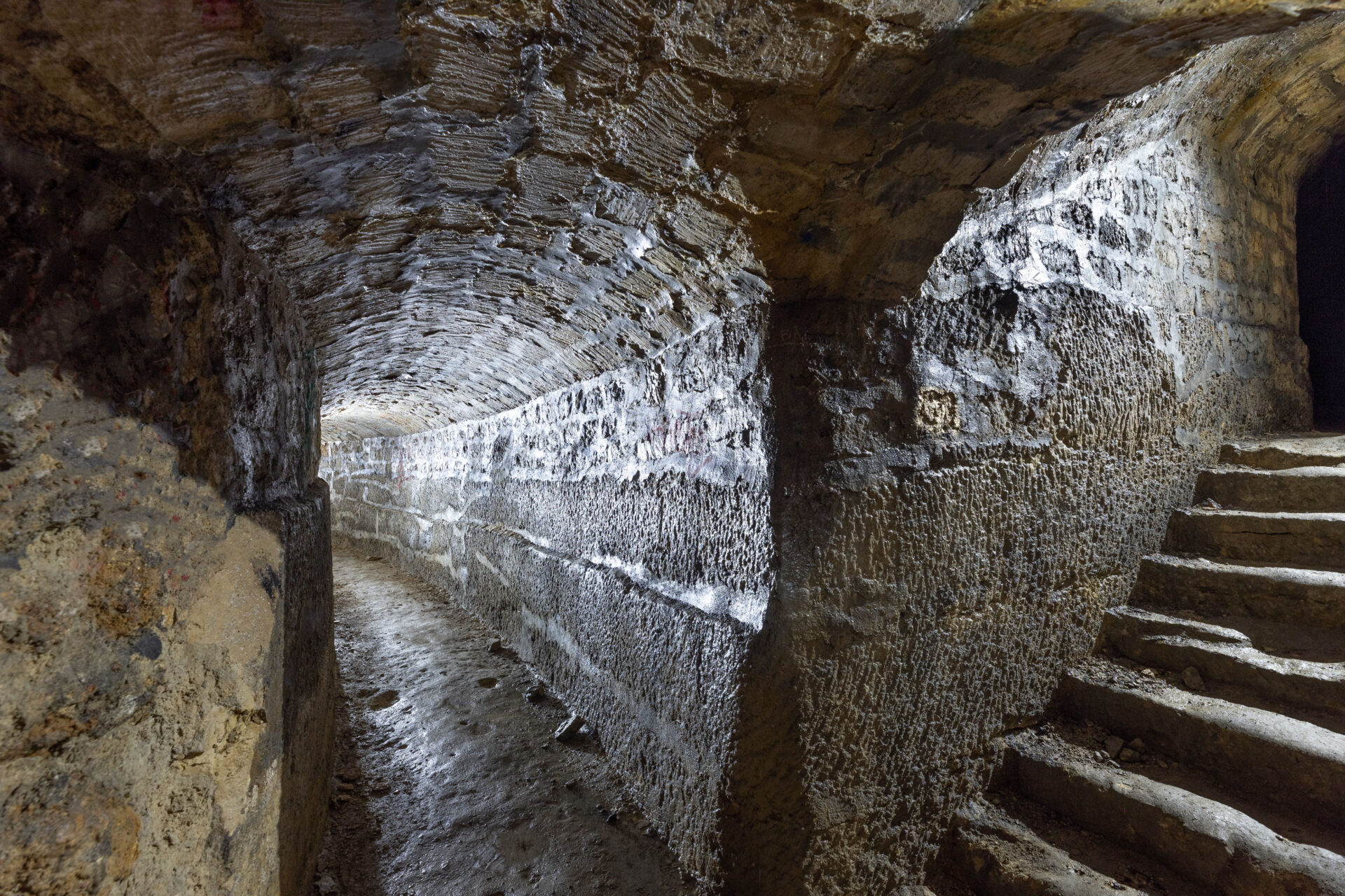
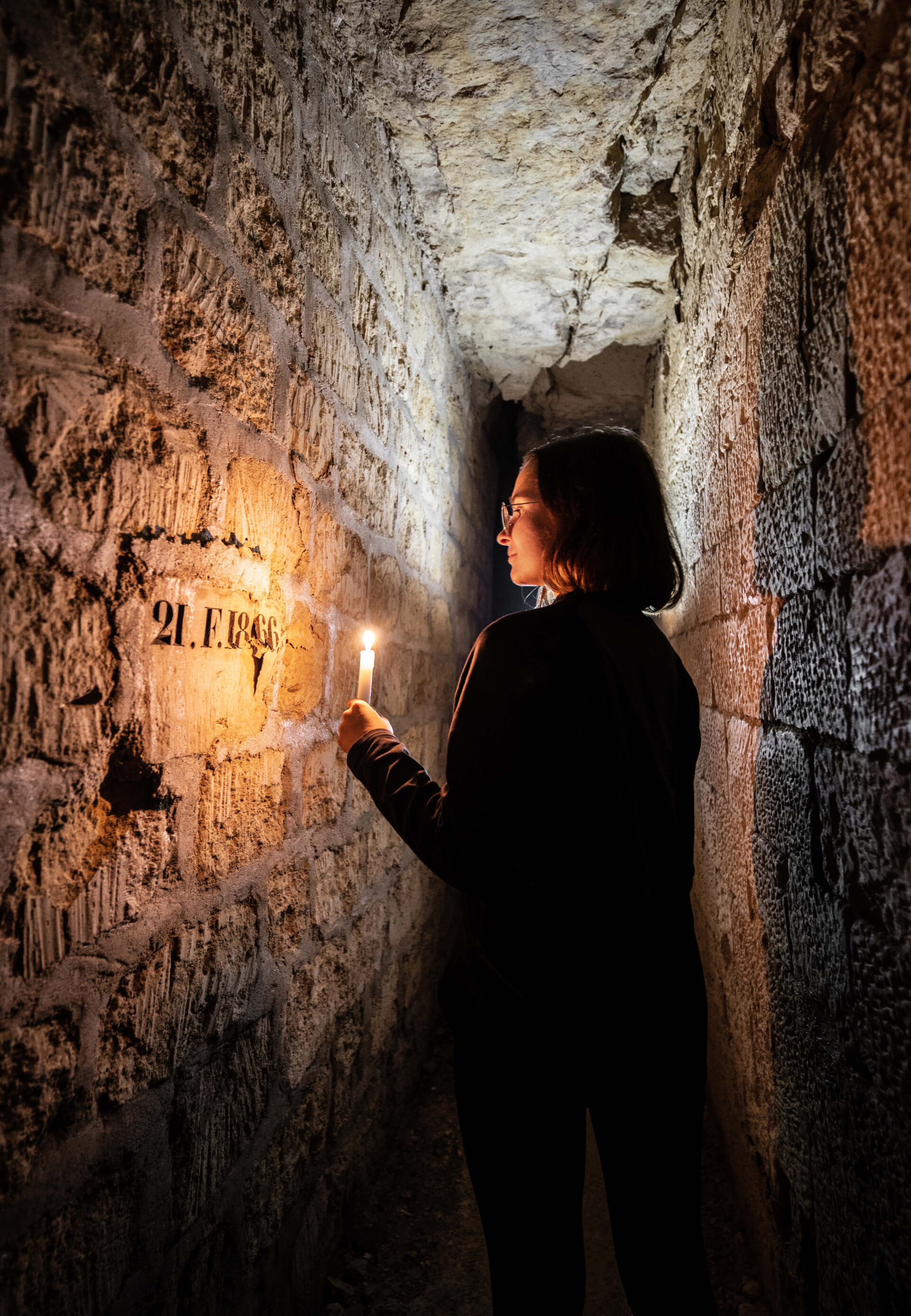
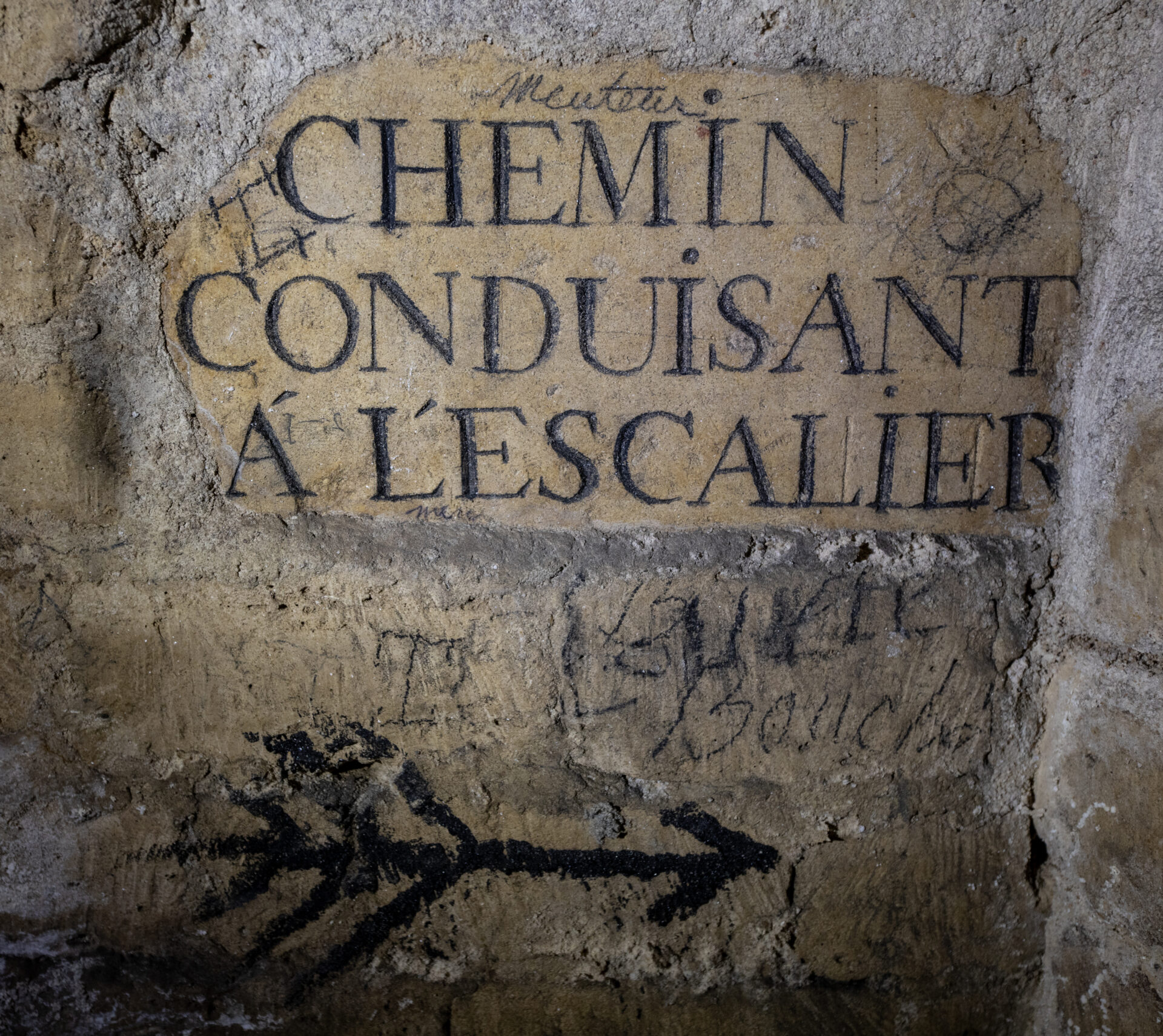
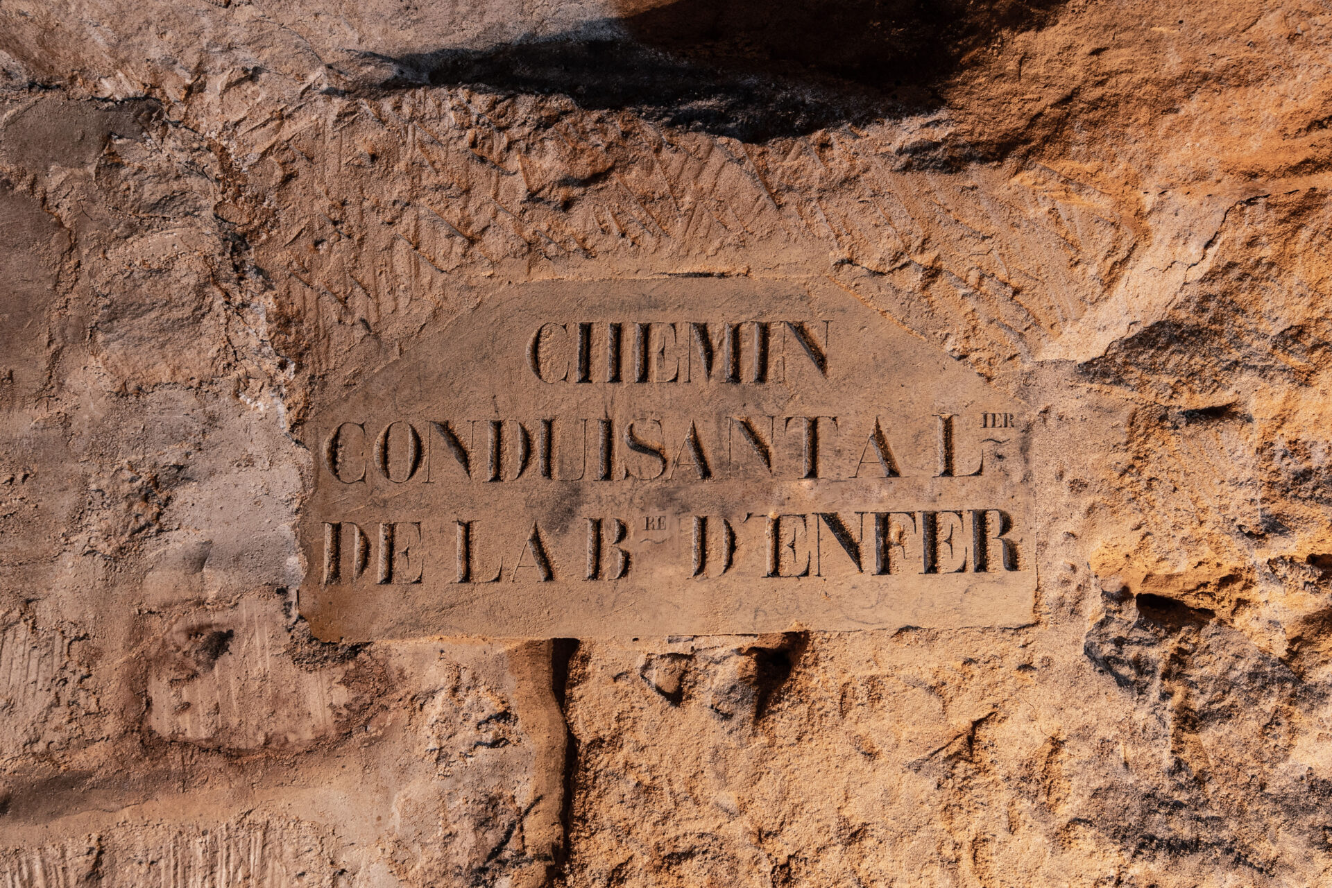
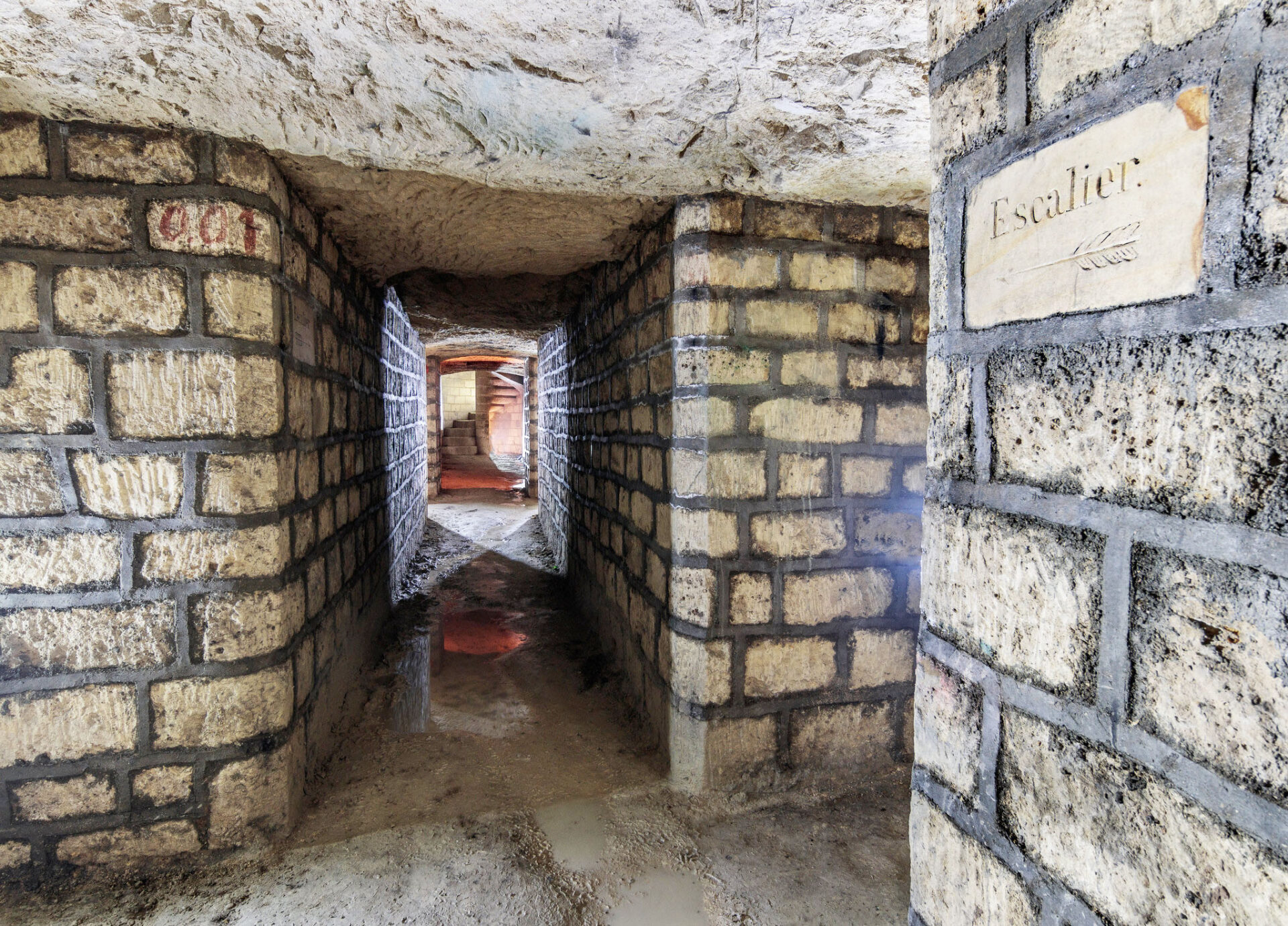
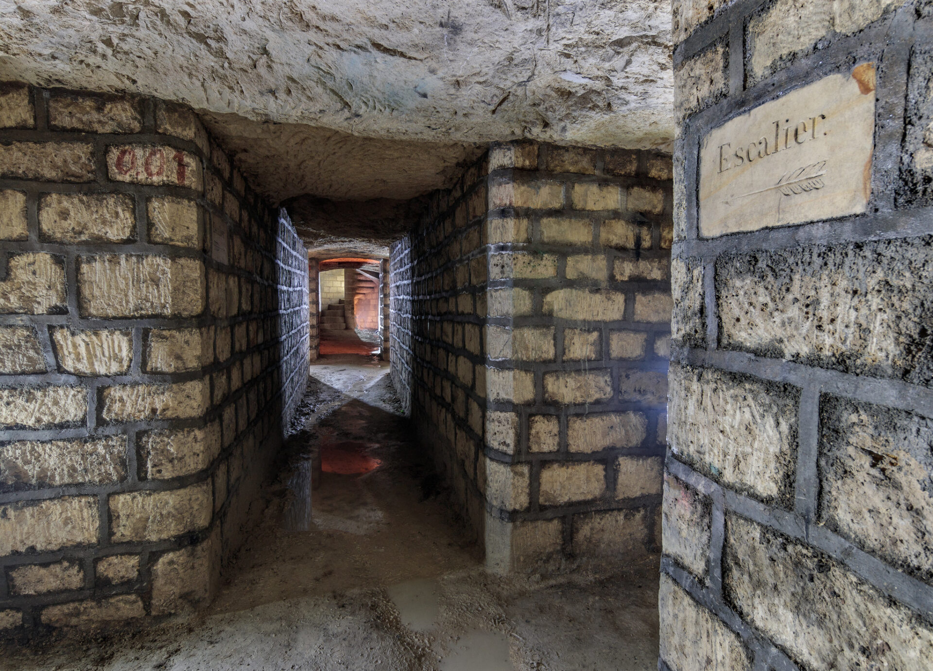
To access these construction sites and inspection galleries, the IGC has over time built stairs and access shafts to facilitate these checks. The stairs also had their own plaque, indicating their depth initially in feet, then in meters after the Revolution.
Plaque indicant le chemin conduisant à l’escalier
Chemin conduisant à l’escalier de la barrière d’Enfer
Escalier de sortie du réservoir de Montsouris
Monitoring of Parisian water tables
Other works, such as digging water wells reaching the water table, were carried out to monitor the water table level in real time in relation to the Seine’s low water level.
To a lesser extent, the IGC has allowed itself some extravagances such as the installation of fountains and mineralogical cabinets. These works have no practical use, but constitute aesthetic and demonstrative works.
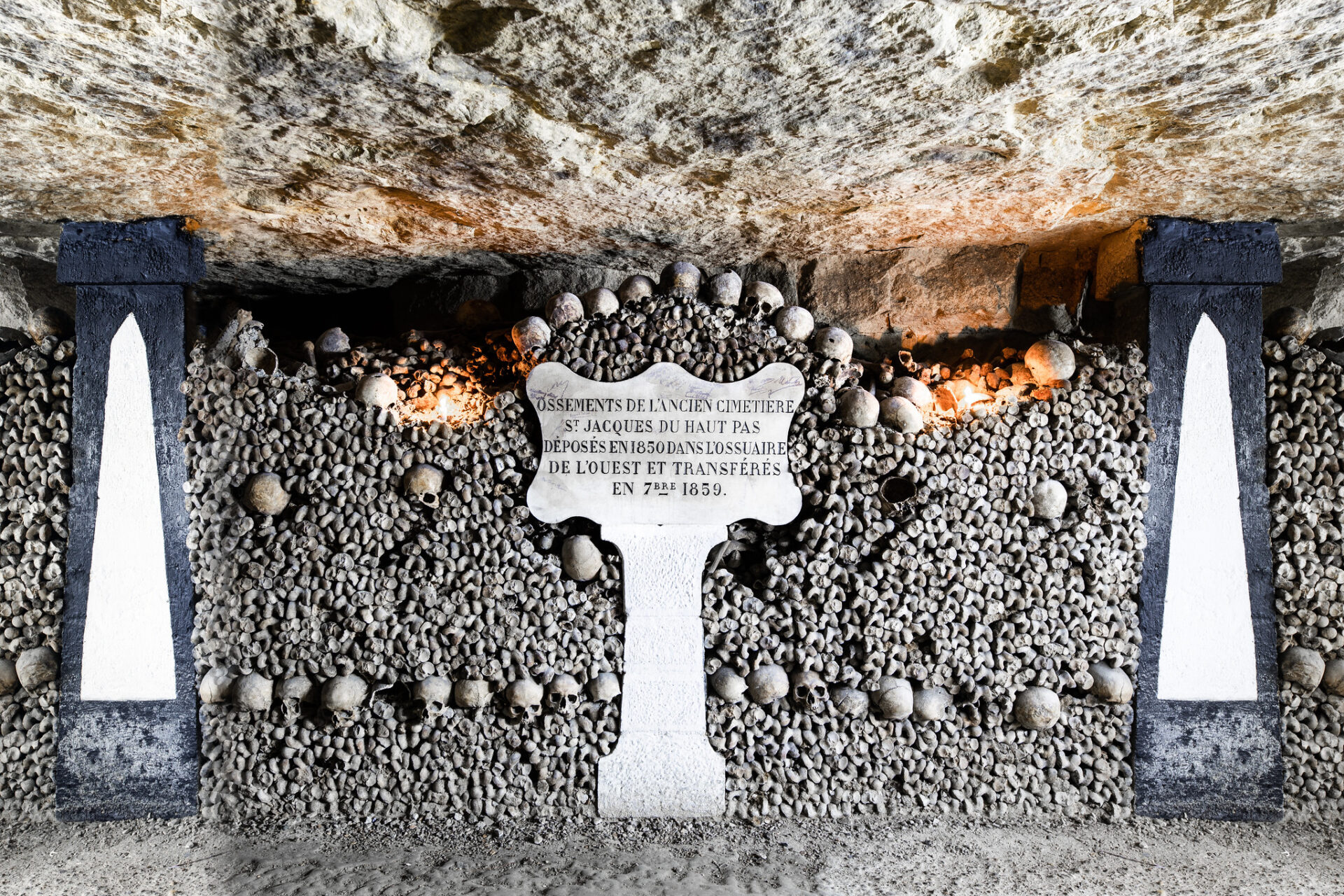
Creation of the Paris Catacombs
At the same time, shortly after the creation of the General Inspection of Quarries, a new function was found for these voids. Between 1786 and 1788, following major epidemics linked to the management of the cemeteries, it was decided to exhume the remains mainly from the cemetery of Saints-Innocents, the largest in Paris, closed in 1780 after centuries of use. The bones were transported and dumped into the quarries through two service shafts, then arranged by quarry workers in the galleries. It was only a few years later that Guillaumot’s successor, Hericart de Thury, decided to develop these bones into the catacomb museum as we know it today.
Today, the IGC still fulfills its role of controlling underground voids and hydrogeological monitoring. The brigade also continues work within the official ossuary when necessary.
Modern uses
Once the main need for security was ensured by the general inspection of quarries, these voids have known various uses under its capital and its suburbs.
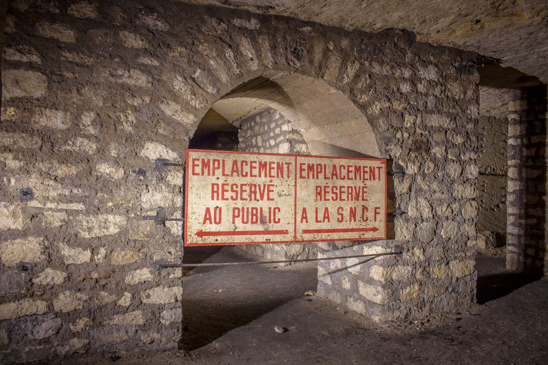
Uses of protection in times of war directly in the quarries or in bunkers fitted out for this purpose as was very common in times of war.
Abri SNCF
Many underground quarries in Paris have been reused as breweries, wine cellars, cheese cellars, storage of foods such as bananas and other beverages due to the favorable climate.
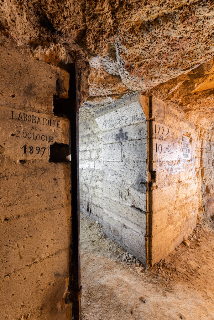
But also for scientific uses as was the case for the famous underground passage of the Jardin des Plantes.
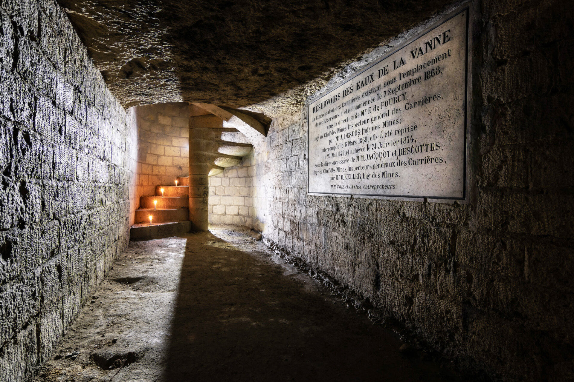
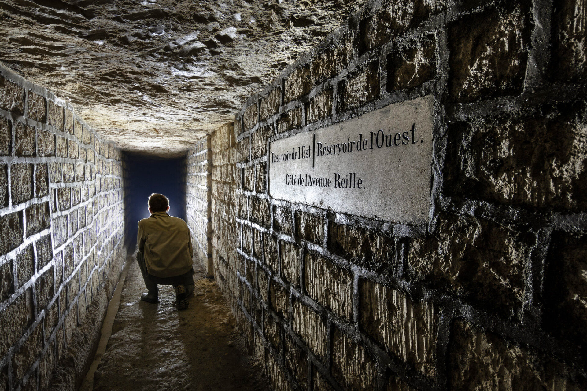
The Montsouris reservoir
The history of the consolidation of the underground quarries under the current Montsouris reservoir begins with the exploitation of a vast quarry until 1850, in the Petit-Montrouge district, outside the limits of Paris at the time. These quarries had to be transformed to accommodate the future reservoirs. To do this, a colossal work was undertaken, involving the construction of 1800 pillars to support the reservoirs.
The work began on September 7, 1868 under the direction of Mr. de FOURCY, Chief Engineer of Mines; Inspector General of Quarries. They were completed on January 31, 1874.
To carry out this work, twenty-two service shafts were dug at regular intervals to allow access to workers and the necessary materials to a depth of about thirty meters. These shafts were placed outside the location of the reservoirs to avoid disturbing the work on the surface.
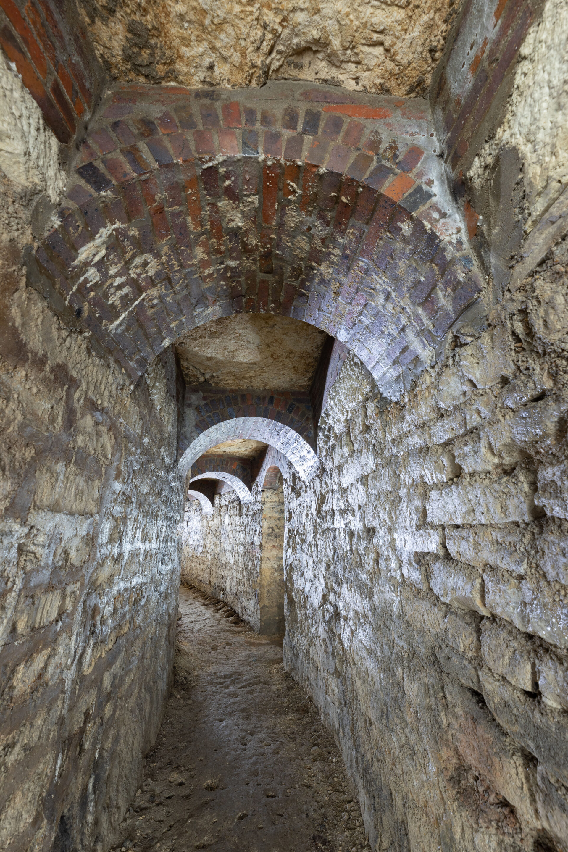
The excavations identified five sinkholes that needed to be consolidated, either with masonry or with concrete fillings from above. The main consolidation method consisted of erecting 1,800 masonry pillars under the 1,800 pillars supporting the vaults of the reservoirs. The space between these pillars was filled with old embankments, consolidated and maintained by series of hedges.
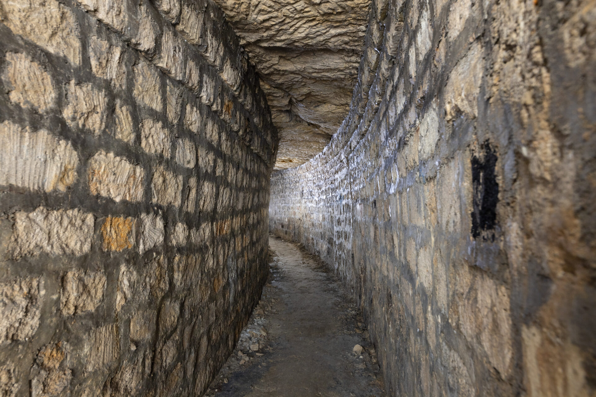
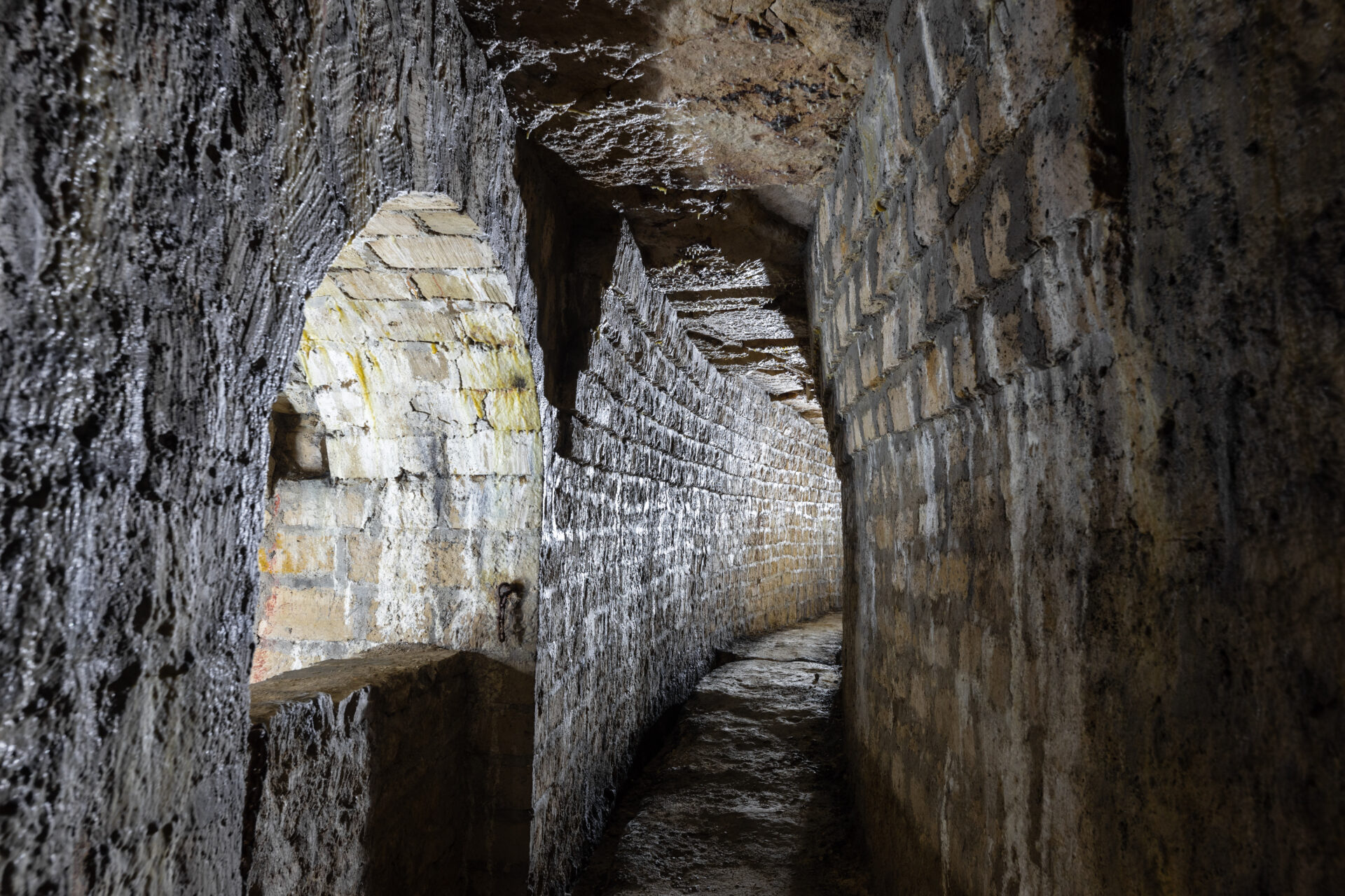
Traffic and surveillance galleries were built in the consolidated quarry, with eight parallel corridors of 260 meters oriented from east to west and twelve perpendicular galleries of 130 meters. In total, 9,920 square meters of masonry were built, representing 27.5% of the total surface area of the reservoir, which extends over 36,000 square meters.
Porte d’accès menant aux carrières situées sous le réservoir de Montsouris
Escalier de sortie des carrières situées sous le réservoir
Plaque de commémoration aux ingénieurs des mines en place à l’inspection générale des carrières
Consolidation d’une cloche de fontis
Plaque de localisation sous le réservoir
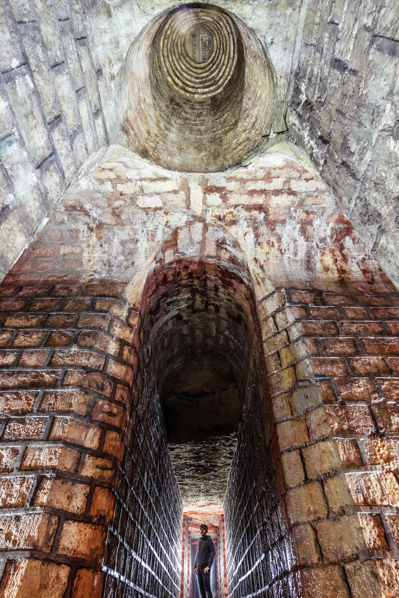
The gas factory
From 1836 to 1937, a gasworks was located on the current site of the Choisy park. When the gas left the furnaces, it passed to the collector, arrived at the condenser, where it was cooled. It was then stored in one of the 7 gasometers, 55 meters in diameter.
To build the enormous bell-shaped gas tanks, it was necessary to secure the old quarries that were located directly above them. The General Inspection of Quarries therefore had galleries built that match the round shape of the gasometers, with a few crosspieces that connect them to each other. Stone vaults and corbels, sometimes in brick, support the sky.
Galerie de visite de l’inspection générale des carrières, entourant le gazomètre
Arche de consolidation autour d’un gazomètre
Escalier reliant deux galeries d’inspection des gazomètres